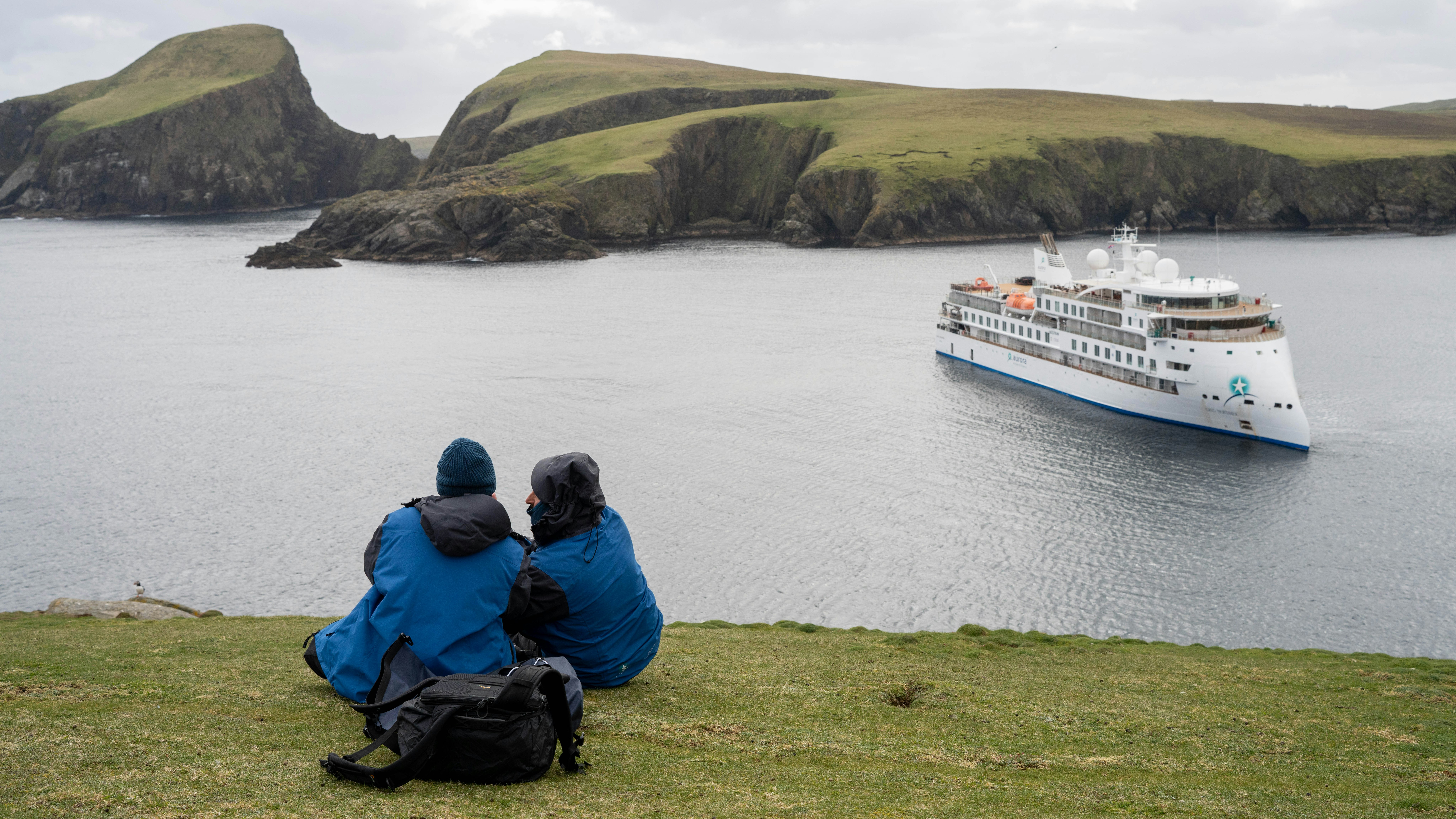
PUFFIN POST - Follow our expeditioners through the Scottish Isles as they make their way from Oban to the Faroes. We've posted their daily updates here, direct from the ship!
MONDAY 11 JUNE 2012 | Day 1 | Boarding Polar Pioneer
The seaside town of Oban forms a picturesque gateway to the Inner and Outer Hebrides—a perfect rendezvous point to begin our voyage. Yesterday a flotilla of fishing boats, ferries and pleasure craft bustled back and forth across the bay to make this the busiest of Scotland’s western ports. By 5pm, with mild temperatures and glimpses of sunshine, we made our way to the Northern Lights Pier to embark on Polar Pioneer.
At 1800 we slipped our moorings and eased out of the bay. Even the nip in the air did not deter us from staying out on decks to soak up the scenic surrounds.
Expedition Leader Gary lured us indoors when he called us together for a welcome briefing in the bar. He introduced the Aurora team, ran through the workings of the ship and spoke about our tentative plans for today. As it is with all of our voyages, our plans remain flexible as they are subject to weather and conditions.
When the ship's horn issued seven short blasts and one long, it was our cue to gather at the muster station on Deck Four behind the bar, don lifejackets, and make our way up the steps and into the lifeboats. We quickly discovered the ambience of these sturdy polar class vessels, cosy even without their full complement of Russian crew.
After a drink in Terry’s bar it was time for our first meal together. We headed down to the dining rooms to enjoy Tim and Rodney’s wholesome cooking.
By late evening, the water was mirror still with steely light and isolated patches of rain. We steamed north of the Island of Mull, taking the scenic route toward Iona. Gannets and gulls crossed our path; clusters of Black Guillemots bobbed on the water.
TUESDAY 12 JUNE 2012 | Day 2 | Iona
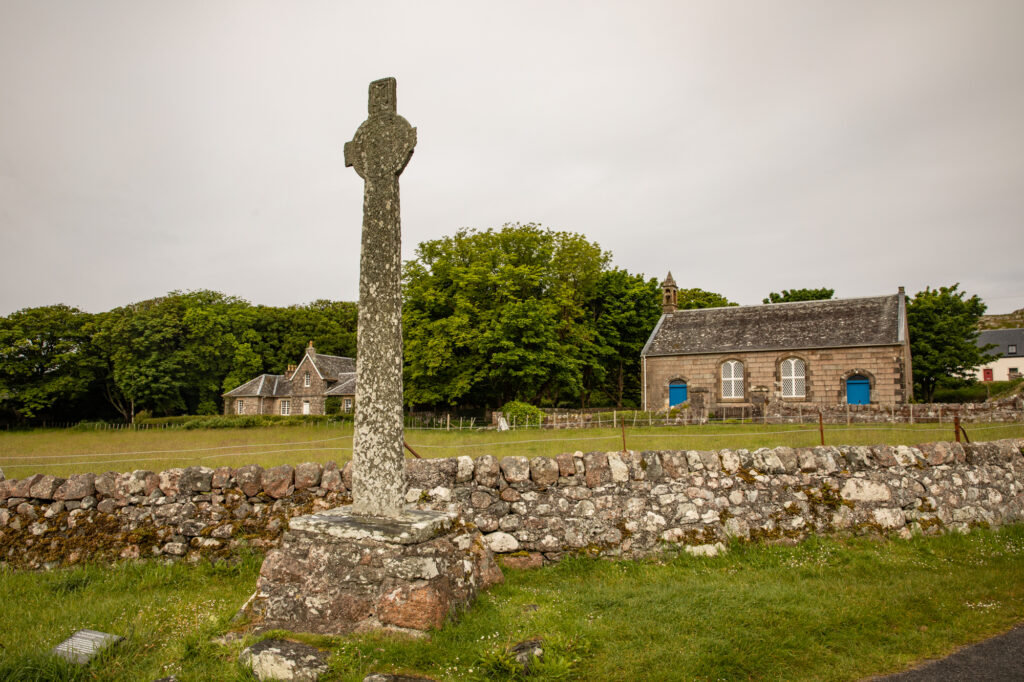
Who says the sun never shines in Scotland? We woke to steely light and from there the sky turned blue and the day grew warm. In the morning, Iona’s winding road led us to the ruins of the old nunnery and on to the historic abbey. Along the way some were treated to the call of the elusive corn crane, though only a few managed to see the actual bird among the tall grasses.
Inside the abbey, Carol shared some of the history of this magnificent landmark from its humble 8th Century beginnings to its grand finale restoration, pointing out structures of the abbey that date back to the 1200s.
Back onboard, our chefs prepared a tasty soup lunch with fresh ship-baked bread, while Captain Sasha upped anchor and steamed north to the Island of Staffa.
Staffa's world famous Fingal’s Cave has fuelled the imagination of creative souls such as John Keats, Mendelssohn, JWM Turner, William Wordsworth, Sir Walter Scott, Jules Verne and Robert Louis Stevenson. Staffa translates to stave or pillar island and refers to the basalt columns that resembled the vertical log staves used by the Norse for house construction.
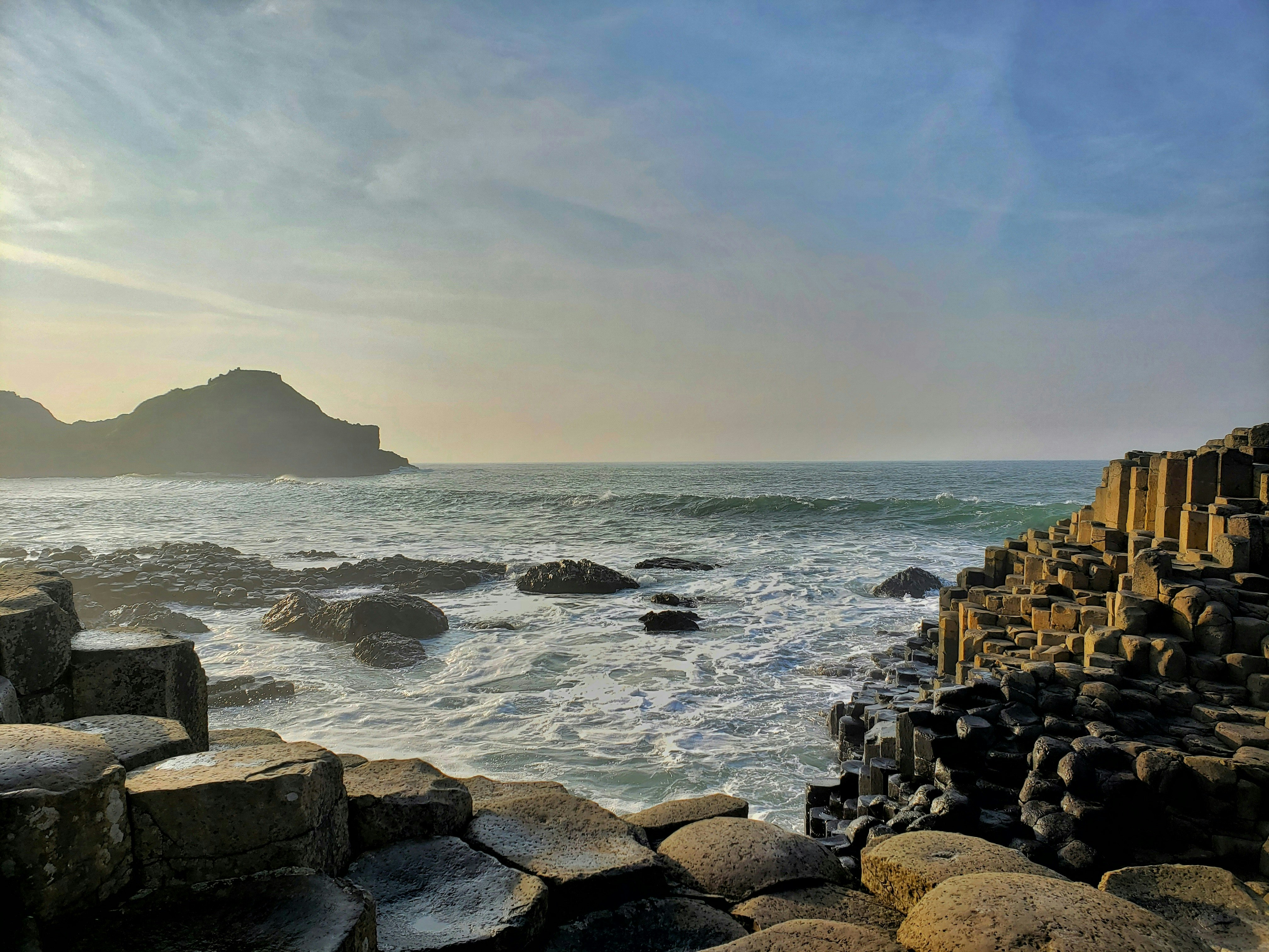
Here, on a calm sunny (hot!) afternoon we cruised around perfectly formed basalt columns that rise 40-metres from the sea. These volcanic columns are the result of slow cooling that caused the lava to split into regular pattern of hexagonal and occasional pentagonal columns. In places along the cliffs the columns have been so contorted that the entire area resembles a magnificent sculpture garden. These same geological volcanic processes also created the Giant’s Causeway in Ulster, Ireland.
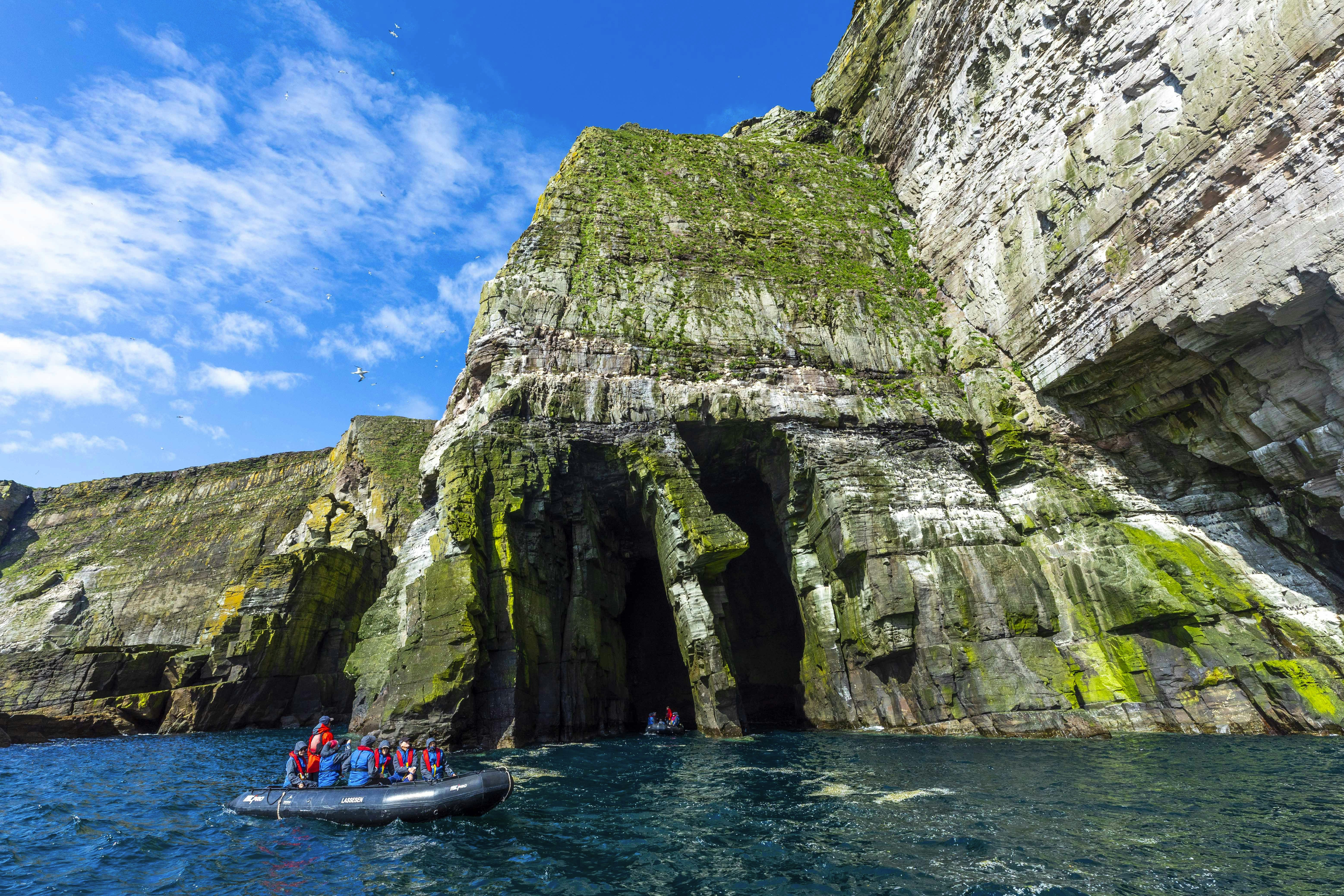
The rare calm conditions allowed each Zodiac to venture deep into Fingal’s Cave. Above us was a remarkable domed roof of naturally sculpted rock. Robyn’s Zodiacers sang Jackie a happy birthday, our choir’s voice rebounding throughout nature’s sea carved auditorium. Hardy kayakers Al, Cathy, Bob, Bruce and Karla cruised into Fingal’s Cave and a number of adjacent caves and inlets. Puffins and gulls perched on craggy ledges and swept across the water.
Captain's pre-dinner drinks was an opportunity to meet Captain Sasha who, along with Chief Mate Bogdan, has been working on Polar Pioneer since its maiden voyage in 2000.
But our first day wasn’t over. We arrived at the picturesque town of Tobermory where, after dinner, we Zodiaced ashore to spend a couple of relaxing hours.
WEDNESDAY 13 JUNE 2012 | Day 3 | Island of Skye
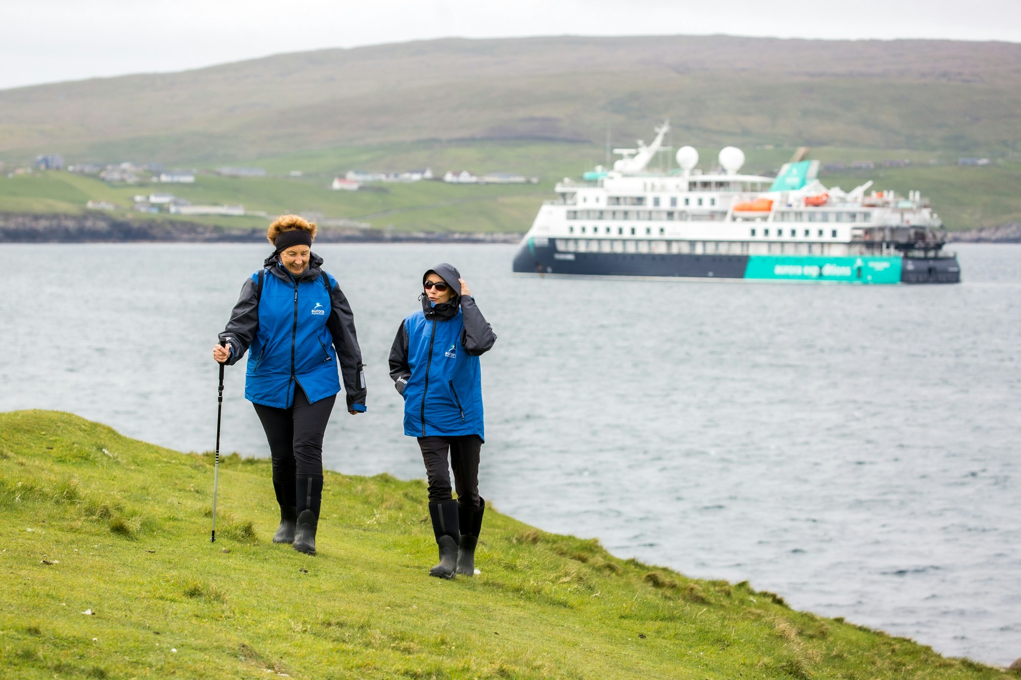
What a ripper of a day for a morning walk around a tranquil loch on the Island of Skye. Fitted with gumboots, we set off in zodiacs, stopping to observe a colony of common seals hauled out on a rock and lazing in the balmy conditions. Seals’ heads bobbed up in the water to check us out.
Onshore we chatted to some hikers who were camped in the region. Meanwhile we peeled off layers of clothing with the day warming by the minute. In beautiful sunshine we hiked along the western bank of Loch Coruisk. The paddlers’ hopes of portaging their kayaks upstream to paddle the length of the loch were put to paid by drought conditions and a lack of running water (even the peat bogs had dried out!). Such a venture would have meant a long steep haul over dry rocks.
Those of us on the track rested at a scenic lookout and listened as Carol shared tales of the landscape and its history. Quite a few of us opted to continue on our trek, all the way to the head of the loch and down the other side to complete a full circuit. Going was harder on the far side, but still very beautiful along with good walking conditions.
Once back on board we discovered we were FAMISHED: Tim and Rodney’s paella was a delicious reward after the morning’s activities.
In the afternoon we relocated to Rubh' an Dunain, a beautiful and archaeologically important peninsula in the southwest of Skye. The sunny weather was stunning when we went ashore near an ancient canal used as a shipyard in Viking times. Carol was in her element as we semi-circumambulated the small loch. We saw ruins from neolithic times, from Viking times and from a mere two centuries ago. There were clear traces of agriculture and houses, a fantastic chambered cairn at the far end of the loch and the ruins of the fortification on the cliffs above the sea. The afternoon was truly hot and sun-drenched; some were happy to simply sit and take in the meditative surrounds.
The day was topped off by a few glimpses of a minke whale lolling about the bay.
THURSDAY 14 JUNE 2012 | Day 4 | Calanais
This morning, we made the long Zodiac ride to the wondrous Calanais Standing Stones, where Carol explained the significance of this important site, and the emphasis the early people placed on the interrelationship between the lunar cycle, the changing seasons, life, growth and fertility. A very special place to spend our morning.
Our kayakers ferried their craft into Calanais and from there set out around the coastline with the plan to meet us for our afternoon landing. They had a wonderful paddle, with a four-knot current running, and found an idyllic cove to stop and enjoy a packed lunch. Despite the wind getting up in the afternoon, only the final leg of paddling to the site of Bostadh House proved to be a little heart-racing through rough and choppy conditions.
We all came ashore on a sandy white beach and wandered grassy dunes to Bostadh House (pronounced 'Bosta')—a reconstructed iron-age home with a distinctive thatched roof. Once inside the stone hut it took time for our eyes to grow accustomed to the dark—and the fug of peat smoke. The hut accommodated all of us and we were surprised at how sizable and snug the indoor living area must have been. Elizabeth, the local islander who tends the house, spoke about the daily life of this ancient community. The hut is remarkably efficient in keeping out rain and wind, the roof vent draws smoke from the peat fire, and the house accommodates a store room which remains several degrees cooler than the main room.
We had time to wander the grassy slopes of this special site, perhaps reflecting on how different life would have been during the Iron Age.
After another delicious dinner, some opted to settle in for the night, while three zodiacs wended their way to the island of Pabay Mór (big island of the priest). Pabay Mór was purchased for £19,000 in 1983 by a private buyer from London who visits the island for a month each summer. A relaxing evening was spent ambling over grassy hills in evening sunshine and communing with the local population of sheep.
Friday 15 June 2012 | Day 5 | Boreray & St Kilda
On a wild sunny morning the prospect of landing at St Kilda looked grim indeed—putting two Zodiacs in the water confirmed just how boisterous were the seas, with waves heaving against the gangway. We changed our morning plans and instead Polar Pioneer headed out to the northerly island of Boreray, taking in Stac Lee and Stac an Armin, where 750,000 Northern gannets nest and breed. The rocks were swarming with colonies of birds that comprise 25 percent of the world’s gannet population.
Along the way we motored past the Island of Soay, whose sheep date back to 5,000BC. One sight of the island’s perilously steep slopes and 380-metre-high cliffs gave us an appreciation for the agility of these hardy goat-like creatures. Soay sheep have never been shorn; instead, their fine soft wool is plucked during summer when the animals are shedding their fleeces naturally.
Once we rounded Boreray and changed course downwind, conditions eased enough for us to negotiate a lunch of delicious homemade French Onion Soup, though there were a few empty seats in the dining rooms as a result of the dreaded mal de mér.
Captain Sasha brought Polar Pioneer around to the lee of Dun Island off the main island of Hirta and manoeuvered the ship to give us protection to board Zodiacs. It was to be a long, wet bronco-busting ride. Once we rounded the corner of Dun’s point and felt the brunt of the wind and an onslaught of confused waves, we got to appreciate why St Kilda is considered so inaccessible. We clawed our way across Village Bay to reach the protection of the landing pier. Finally we set foot on this infamous Atlantic outlier.
St Kilda has been continuously inhabited for at least 2,000 years, evident by numerous archaeological sites at the main settlement, including the Earth House dating back to 400BC–500AD. More recently, during the 18th century, the islanders made a living by collecting thousands of gannets and fulmars for their oil, used for ointments and fuel, while the feather of fulmars and puffins were exported for bedding. Black-faced Soay sheep provided the St Kildans’ an export in wool, along with provisions of meat and milk.
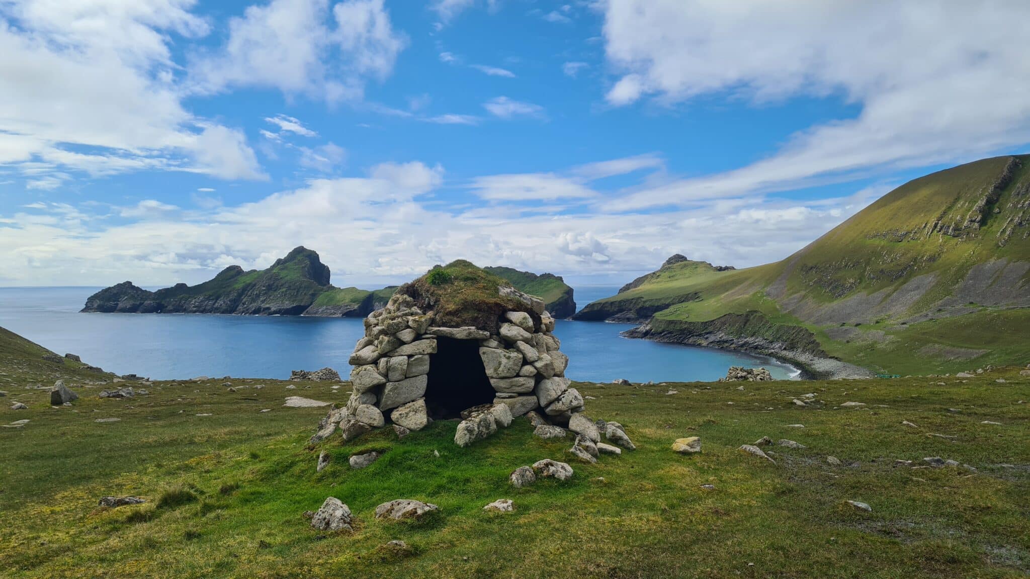
Carol guided a walk around the main settlement, where several of the sixteen stone houses have been restored. Carol explained the ways of a Stone Age culture, and how the numerous cleits—small turf-roofed drystone structures dotting the landscape—were used as larders for storing seabirds and general stores. During the walk, flocks of Soay grazed the lush grass pastures.
When it was time to head home, Robyn and Terry’s Zodiacs pioneered the narrow channel between Dun and Hirta. Despite the channel looking like the inside of a washing machine, with partially submerged rocks enroute, the Zodiacs negotiated the turbulent channel that provided a shortcut to the protected waters on the south side of Hirta: there our trusty Polar Pioneer lay in wait.
Carol topped off the St Kilda experience with an entertaining pre-dinner talk, then those of us who were of a mind to eat, sat down to dinner and later joined Terry in the bar for some friendly company and drinks.
Saturday 16 June 2012 | Day 6 | Sula Sgeir & Island of Rona
The remote rocky outcrop of Sula Sgeir is the stuff of legends. It was to this lonely pile of rocks that Saint Ronan, in the eighth century, banished his sister to a life of exile—the good Saint vexed by improper thoughts after a glimpse of his sister’s ankle and her shapely calf. Sula Sgeir translates to gannet skerry, and these days is inhabited by tens of thousands of Northern gannets. While conditions were too rough for a Zodiac cruise, we enjoyed a ship cruise close to the island. From the bridge we spotted numerous rock structures dotted along the skyline. These small stone houses, known as bothys, were for centuries used by men who arrived at the island annually to collect the gannet chicks; to this day the guga, as they are known, are regarded as a delicacy. The men would stay at the island for several weeks, until the guga were almost ready to fledge—tender and prime for eating and for oil. The feathers of the dead birds were singed in an open peat fire; the carcasses stacked up to cure in salt air. One of the earliest recorded accounts was by Dean Munro who visited the Western Isles in 1549 and wrote of the Nessmen who sailed here in their small craft to ‘fetche hame thair boatful of dry wild fowls with wild fowl fedderi.’ To this day, ten men from the Isle of Lewis are licensed to carry on this age-old custom.
By mid afternoon we arrived at the remote Island of Rona and found protection from the wind in the lee of the island. From the ship we were able to make out St Ronan's Chapel, possibly the oldest Christian building in Britain, dating back to 700 AD. The paddlers set off to explore the coastline, while Zodiacs spent a leisurely couple of hours exploring the sheltered coastline with its myriad of curious seals and seabirds. Puffins beat overhead or gathered on the sheltered waters in large groups. Guillemots, fulmars, gulls and cormorants added to the array f birds nesting along craggy cliff faces. Rona was declared a nature reserve in the 1950s because of its importance as a seabird breeding ground.
Back on board we made our way to the bar for a recap, hosted by Santi. So many things have happened since we left Oban that it was time to relax for an hour before dinner and share our impressions of the last action-packed days.
Sunday 17 June 2012 | Day 7 | Stenness & Skara Brae
At Mainland Orkney we left the ship for a full day onshore. We met our tour coach and headed off around the main island. We passed Maes Howe—a large chambered neolithic cairn—where, on midwinter's day, the sun shines directly in through the narrow entrance to a central flagstone in the inner chamber. Our first stop was the Standing Stones of Stenness, then on to the nearby Ring of Brodgar, located on an isthmus between Loch Stenness and Loch of Harray. Here, 27 of the original sixty stones still stand. Little is known about the meaning and purpose of these mysterious stones other than their astronomical relationship to an agronomy culture and their significance in marking the changing seasons.
Skara Brae is Orkney's most spectacular and renowned archaeological feature. Despite the chilly wind, we were enthralled by this prehistoric village dating from around 3,100 BC. At around 2,450BC a sandstorm buried the original village, preserving it intact. It was not until 1824 that a ferocious storm eroded the foreshore dunes. The village remained partially exposed until 1928 when the area was meticulously excavated. We wandered around the middens, looking down into individual houses linked by subterranean passages. Each room was designed with a central hearth, a dresser for displaying special belongings, beds, storage areas and personal effects made of clay, stone and whalebone.
We wended our way around the coastline, past Stromness and famous Scapa Flow where, in WWI, over 70 German ships being held in the bay by the British were scuttled by their captains in preference to surrendering the fleet. In WWII Scapa Flow was infamous again, with a German submarine torpedoing and sinking Britain’s Royal Oak with all lives lost. Following the tragedy Sir Winston Churchill ordered the east inlets to the bay be concreted shut.
On the kayaking front, Bob and Al clocked up 20 kms of paddling, with a lovely kayak to the Bay of Firth, north-west of Kirkwall. Along the way they sighted a submersible tidal turbine, being a prototype and the first in Scotland. The pair enjoyed lunch at a lake dotted with male eiders.
With a free afternoon in Kirkwall, some spent time exploring beautiful St Magnus' Cathedral, founded in 1137. For the whisky lovers, a tour of the Highland Park Distillery proved a must.
Monday 18 June 2012 | Day 8 | Papa Westray & Fair Isle
The island of Papa Westray and its larger neighbour Westray are located at the northerly tip of the Orkney group. The islands’ most recent claim to fame is that they boast the shortest regular airflight in the world: a whopping great two minutes from one island to the other! Visitors come from far and wide to take the flight, land at Papa Westray, receive a special certificate and a miniature bottle of Highland Park Scotch whisky before flying back again.
Papa Westray’s more enduring claim to fame is its small but marvellous Knap of Howar, a Neolithic miniature of Skara Brae in the form of two houses that are thought to be the oldest preserved domestic dwellings in Northern Europe. Here Carol gave us an insight into Neolithic life and culture. We were free to enter the two dwellings and get a real feel for island life in 3,700BC.
Jim Rendall, a long-time local of Papa Westray, arrived in his mini van and chauffered some of us up to St Bonifice Church, while the rest of us walked the fields along the coastline and clambered over stiles. Jim added to Carol's commentary about the recent restoration of the church and shared some local knowledge, including tidbits from his own family heritage. Jim told us that the population of Papa Westray, once housing a crafting community of 300, is now reduced to 30.
Many opted to walk back to the pier where our Zodiacs waited. What a perfect clear sunny morning to be ambling down narrow stone-walled lanes. We stopped to watch a farmer tilling soil, his tractor followed by a throng of terns, kittiwakes and gulls who were busily diving into the tilled soil to scoop up worms and grubs.
Back onboard, Santi gave us a lively presentation on Scotland’s marine mammals, followed by a much-welcome ploughman’s lunch—a perfect feast.
When Gary announced 3 or 4 hours of motoring to our afternoon destination Fair Isle, many retired to their cabins for a post-lunch snooze! By mid afternoon we approached the island’s stately lighthouse at the northern tip. The ocean glistered with sunshine and hardly a breath of wind.
Once more we loaded Zodiacs and zoomed into the protected marina. Two local lads offered a taxi service to the south of the island where many enjoyed visiting the museum. The community hall was also busy with the locally made woollen garments for sale that Fair Isle is famed for. By 6:30 in the evening we were all in the vicinity of the Bird Observatory – here two ornithologists gave us a guided tour of the headland, with information on the private life of puffins. We had fantastic close-up views of these adorable birds, and plenty of fly bys, along with great views of fulmars, kittiwakes, cormorants and gulls. Al’s paddlers also enjoyed a spectacular afternoon, soaking up the sun, and exploring the coastline with its books and crannies and deep, dark caves.
By 19:45 we were all back on board, wearied and sated from a day of walking, sun and fresh Scottish air. A delicious fish masala dinner topped off a wondrous day.
Tuesday 19 June 2012 | Day 9 | Shetland Islands
We arrived at the famous Shetland Islands! With morning threats of wind and rain we headed out in Zodiacs for Jarlshof. And what a feast it proved to be. Carol walked us through the progressives ages of remnant villages, from Neolithic, Iron Age, Bronze Age, Viking and Medieval. It was astounding to see so many layers of civilisation at the one site. Perhaps most remarkable was that the earliest stone masonry has outlasted the more modern Medieval ‘round rubble’ masonry of the most recent Grand Manor. We also admired the remaining half of a broch, with a reminder of how much the ocean level has advanced since the early era.
By early afternoon we had arrived at the island of Mousa, famous for Mousa Broch, the finest surviving example of a 2,000-year-old Iron Age tower, or broch. Mousa is one of about 120 brochs built throughout the Shetlands—the only one to be left intact. The broch stands 13 metres tall and measures 15 metres in diameter at its base, although the interior is only six metres in diameter. The long entrance passage is indicative of the enormous thickness of the broch’s double walls that house a staircase leading to the tower roof. Tea candles set the mood while Carol enthralled us with tales of eloping lovers, family feuds and territorial invasions. She created an image of how this mighty tower of stone was built as a fort, fortified house and status symbol, and how its inhabitants would have utilised the numerous chambers and levels.
We also took time to explore nature at this beautiful undisturbed site. At the nearby lake some saw the red throated diver, a rare bird that breeds in Scotland in the northern summer. The island was crisscrossed with walkways, boardwalks and lolling pastures, which meant everyone had time to venture off on their own and commune with the natural environment. The paddlers had a beautiful afternoon, especially as the swell died out to a relatively calm sea.
By evening, when we were all back aboard, conditions were perfect for a barbecue. It might have appeared to happen effortlessly. But in fact Tim, Rodney, Terry and our Russian Stewardesses stayed on board most of the day to prepare for a lovely Aussie-style BBQ and dance on the back deck of our trusty Polar Pioneer. The wind petered away and we enjoyed great food and company, silly hats and crazy dancing. What a stupendous day in wild Scotland.
Wednesday 20 June 2012 | Day 10 | Foula Island
Scotland turned on a perfect summer’s day and we headed into Foula Island across a calm oily sea. Some took to the high road and others to the low—across the island marched the brisk walkers to Sneck de Smailie, there to enjoy sightings of puffins, razorbills, guillemots and fulmars. A few ventured along the shorter coastal walk, soaking up the scenery with its dramatic bays and cliffs studded with nesting fulmars and puffins. The kayakers explored the coastline, meandering through colonies of puffins rafted on the water. The school and community centre were also an attraction, the children having prepared for our visit. Finally, a pair of adorable Shetland ponies arrived at the landing pier as we were readying to return to the ship.
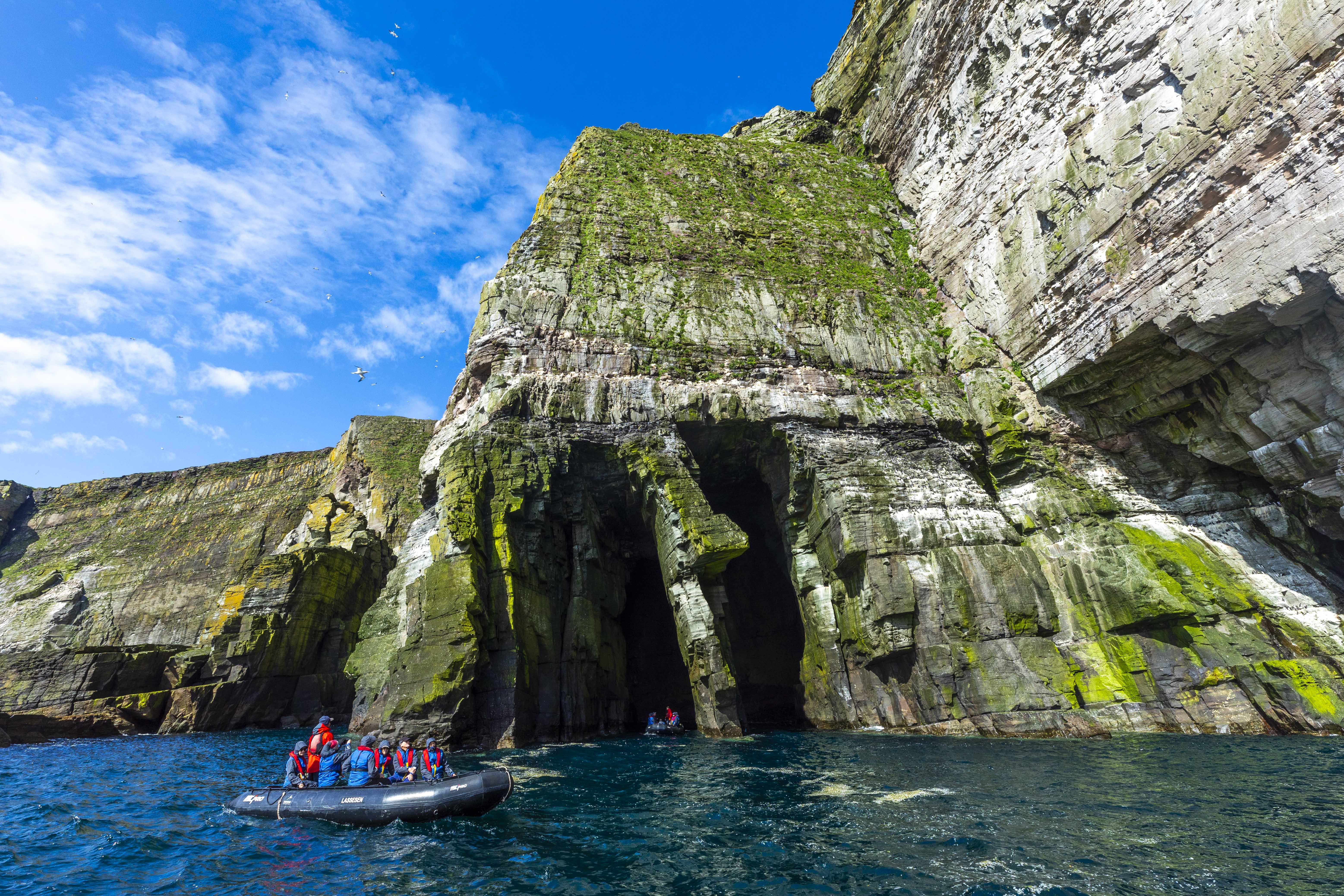
The island of Papa Stour, located halfway up the west coast of Mainland Shetland, was a dramatic place to spend our final afternoon around Scottish shores. This fertile island is formed from volcanic lava and ash. Over millenniums the entire rocky coastline has been sculpted by ocean carving away the soft ash and leaving the hard volcanic base— thus forming some of the finest sea caves in Britain.
The paddlers, including our two chefs Tim and Rodney, set off in their colourful craft, while the rest of us piled into Zodiacs and made for the sou'west side of the island to explore subterranean passages and caves. The premium conditions meant that we could venture into caves that we have never before been into due to sea conditions, The afternoon was so still that we were able to explore the full length of 70-metre-long Christie's Hole—the longest sea cave in Scotland.
From there we Zodiaced into shore where two dinghies were housed in their own noos, a snug storage cradle dug from the ground at the top of the beach. Carol led the group up to a chambered cairn at the brow of the hill where, in the short time we had left, she spoke about ancient times.
Back onboard Terry’s bar was abuzz with margarita-making and colourful cocktails with enticing names such as ‘Rosy Apple’. Carol and Alison were in charge of the festive dress code in honour of leaving Scotland and preparing for Midsummer’s Day.
Thursday 21 June 2012 | Day 11 | Faroe Islands
The Fabulous Faroes! With our pilot aboard we eased into the pier at Faroe's capital city Tórshavn. This was no sleepy fishing village: this was a full-on, thriving city of 20,000 proudly independent Faroese. Not only was the distinctive Faroe Islands flag flying, with its white background, red cross and blue outline; alongside it fluttered the 'midnight sun' flag of Greenland, also a Danish dependency, celebrating its National Day.
We spent the afternoon on a tour with a difference. Our friendly guide invited all forty of us into his home to experience a modern day Faroese house (such a house with a view sells for around $500,000 USD.) Someone asked if his wife would mind the mass intrusion. ‘Don’t worry,’ he said, ‘she’s not home.’ What a warm, bright and lovely home it was. And what a contrast in architecture to the historic village of Kirkjubour, where we explored a 900-year-old farmstead with it turf and birch bark roof, and the ruins of an ancient stone cathedral. Our guide offered a refreshing perspective on the Faroes; throughout the afternoon we gleaned plenty of tidbits: Tórshavn is known by the locals as Havn (pronounced 'Houn'); 70,000 sheep graze on the islands; fishing (including farmed fish) makes up 50% of the Faroe economy, and for this reason, the Faroese are reluctant to become part of the EEU; fishing is regulated not on a quota system—rather, each boat is allocated a specified number of fishing days. Faroese are soccer mad, with 18 soccer clubs among a total population of 50,000; 2 million fulmars and 1 million puffins inhabit the islands. The Faroese flag was designed in 1919 by students and became the official flag in 1940. One enduring impression from what we learned—aside from the sense of pride the Faroese have for their remote homeland—is the sense of unity among the islands, and the importance of physical connections between the islands of the archipelago, whether by sea tunnel, bridges, buses or the regular ferry services. Indeed, the printed guides illustrate the transport system as if it were a regular London Metro.
Our coach tour ended in the centre of town, with several hours to explore the shops and waterfront, and enjoy a cup of coffee in a chic café or a rather expensive beer. A marvellous spectacle was the various rowing teams fanging across the harbour in their Viking-like 8-person vessels, training for a kilometre-long race that is a seasonal event. Alas, poor Cecily came to grief on the cobbled waterfront, falling heavily and dislocating her shoulder. Partner Phil and Dr Ali whisked Cec’ off to the hospital for xrays where the wonky shoulder was relocated. Cecily returned to the ship a tad under the weather from a cocktail of pain killers and anaesthetic but coherent enough to order a soothing brandy and dry.
Friday 22 June 2012 | Day 12 | Mykines & Streymony
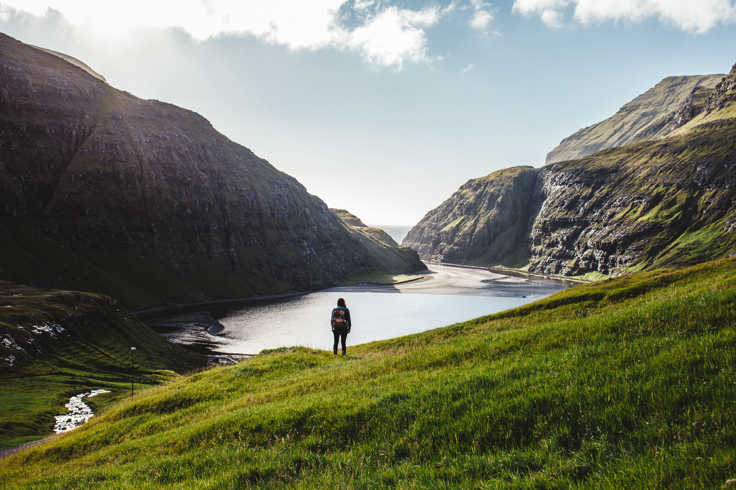
Our morning landing at Mykines, the most westerly of the Faroe Islands, was once again blessed with mild weather. Those who chose not to immediately clamber up to the headland to view the puffins, took a stroll in the village with guide Anna Sofia. Meanwhile Santi led the mountain goats over the bridge that connects the island of Mykines with Mykinesholmur—the group trekking all the way out to the lighthouse and back. The majority of us were content to remain on the main island headland to savour close-up encounters with puffins and fly-bys by kittiwakes. The extraordinary views of Mykines' coastline included wild rugged promontories, lush green slopes, grazing sheep, and the colourful Nordic village tucked into the protection of the valley. Pure magic.
We returned to our trusty Polar Pioneer for another delicious lunch while the ship relocated to the western side of the island of Streymoy and the Vestmanna Sea Cliffs. There, we ventured out for an unforgettable afternoon on the water, either by Zodiac or kayak. Cruising at the Vestmanna Cliffs, especially on a perfectly still, sunny afternoon, was a sensational experience. We cruised several kilometres along a labyrinth of passage ways, natural arches, grottoes, sea stacks, hidden alleyways, past waterfalls and cliffs that towered hundreds and hundreds of metres above us. Squadrons of puffins bobbed on the water, fulmars and kittiwakes flew overhead, the distinctive male eider ducks frequented the coastline, and guillemots and razorbills nested on protected ridges. It was the scale and grandeur of the cliffs—rising to over 400 metres—that took our breath away and had cameras on motor drive throughout the afternoon.
The paddlers also took the opportunity to spend their hours kayaking and exploring, and had a fantastic time of it. Only when we saw the size comparison between the kayaks or Zodiacs against the magnitude of the cliffs did we gain a full appreciation for the scale of the place.
Tim and Rodney treated us to a delectable Russian dinner, then we upped anchor and moved further north. Overnight we will motor around the northern flank of the Faroes, passing the country’s highest mountain (Slaettaratindur—882 metres) and the twin sea stacks Risin (75m) and Kellingin (73m). The two stacks, as legend goes, are remnants of an attempt by an Icelandic giant and his troll wife to tow the Faroes back to Iceland. They tied a rope around the northern end of the island of Eysturoy (Easter Island) but quarrelled for so long that they were caught by the rising sun and transformed into stone.
Tomorrow is our last full day of activities at the islands of Vidoy and Svinoy with an opportunity to experience a midsummer Faroese festival. As this will be our final Puffin Post for our voyage, we bid you a fond farewell and wish you safe onward travels.

-TOURISM-IRELAND.jpg?language=en&auto=format&w={width}&fit=cover)
